🎯 Lesson Objective
By the end of this lesson, learners should be able to:
- Understand what a Cartesian coordinate system is
- Identify the x-axis and y-axis
- Plot and interpret points on a coordinate plane
- Understand ordered pairs (x, y)
- Apply coordinate systems in real-world fields such as statistics, data science, artificial intelligence, engineering, and navigation
📖 Introduction
In mathematics, the Cartesian Coordinate System is used to locate points in a plane using numbers.
It allows us to describe the exact position of objects using coordinates.
The system was developed by the mathematician René Descartes, which is why it is called Cartesian.
This system is widely used in:
- mathematics
- physics
- engineering
- statistics
- computer science
- artificial intelligence
- GPS and navigation systems
Without coordinate systems, it would be extremely difficult to describe the position of objects in space or analyze relationships between variables.
📍 The Coordinate Plane
Two perpendicular lines form the coordinate plane.
These lines are called axes.
The two axes are:
1️⃣ The Horizontal Axis (x-axis)
The x-axis runs from left to right.
It represents horizontal movement.
Values increase as you move to the right and decrease as you move to the left.
Example:
- x = 5 means moving 5 units to the right
- x = −3 means moving 3 units to the left
2️⃣ The Vertical Axis (y-axis)
The y-axis runs from bottom to top.
It represents vertical movement.
Values increase as you move upward and decrease as you move downward.
Example:
- y = 4 means moving 4 units upward
- y = −2 means moving 2 units downward
📌 The Origin
The point where the x-axis and y-axis intersect is called the origin.
The coordinates of the origin are:
(0, 0)
This point represents the starting position of the coordinate system.
Every other point is measured relative to this point.
🔢 Ordered Pairs
Locations on the coordinate plane are described using ordered pairs.
An ordered pair has the form:
(x, y)
Where:
- x represents horizontal position
- y represents vertical position
Example:
(3, 2)
This means:
- move 3 units to the right
- move 2 units upward
📊 Example 1 — Plotting a Point
Plot the point:
(4, 3)
Step 1
Start at the origin (0,0)
Step 2
Move 4 units to the right along the x-axis
Step 3
Move 3 units upward along the y-axis
The final position represents the point (4,3).
📊 Example 2 — Negative Coordinates
Plot the point:
(-2, 5)
Step 1
Move 2 units to the left along the x-axis
Step 2
Move 5 units upward
Final coordinate:
(-2, 5)
This shows how coordinates can represent positions in different directions.
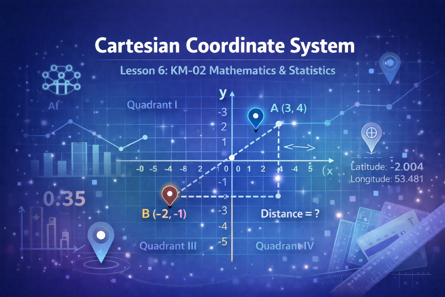
🧭 The Four Quadrants
The coordinate plane is divided into four regions called quadrants.
These quadrants help identify the sign of coordinates.
Example:
(4, 3) → Quadrant I
(-5, 2) → Quadrant II
(-3, -4) → Quadrant III
(2, -6) → Quadrant IV
🌍 Real-World Applications of Coordinate Systems
The Cartesian coordinate system is used in many important fields.
1️⃣ GPS Navigation
GPS systems use coordinate systems to determine locations on Earth.
Your smartphone calculates your position using coordinates.
Example:
Latitude and longitude are coordinate systems used in navigation.
2️⃣ Computer Graphics
Video games and animations use coordinate systems to position objects on the screen.
For example:
- a character’s position
- movement of objects
- camera positions
All rely on coordinate calculations.
3️⃣ Artificial Intelligence
Machine learning models often analyze data points on graphs.
Each data point may represent coordinates such as:
(x = study hours, y = exam score)
This helps algorithms identify patterns.
4️⃣ Engineering and Architecture
Engineers use coordinates to design buildings, bridges, and machines.
Coordinates help determine:
- exact locations
- distances
- structural alignment
📐 Distance Between Two Points
One important use of coordinate systems is to measure the distance between two points.
Example:
Point A = (1,2)
Point B = (4,6)
Using coordinate calculations, we can determine how far apart these points are.
This concept is extremely important in:
- robotics
- machine learning
- navigation
- mapping systems
⚠ Common Mistakes When Working With Coordinates
Students often make the following mistakes:
Mistake 1
Confusing the order of coordinates.
Example:
(3,5) is not the same as (5,3)
Mistake 2
Forgetting that negative values move left or downward.
Mistake 3
Starting movement with the y-value instead of the x-value.
Always move:
horizontal first (x)
then vertical (y)
🧠 Key Takeaways
The Cartesian coordinate system allows us to:
- represent locations using numbers
- analyze relationships between variables
- create graphs and models
- solve real-world problems in science and technology
Understanding coordinate systems is fundamental for advanced topics such as:
- algebra
- statistics
- machine learning
- physics
- engineering